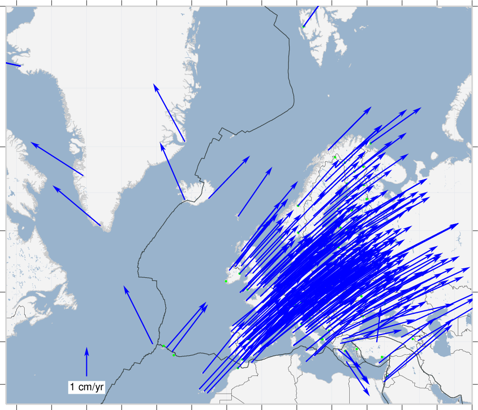
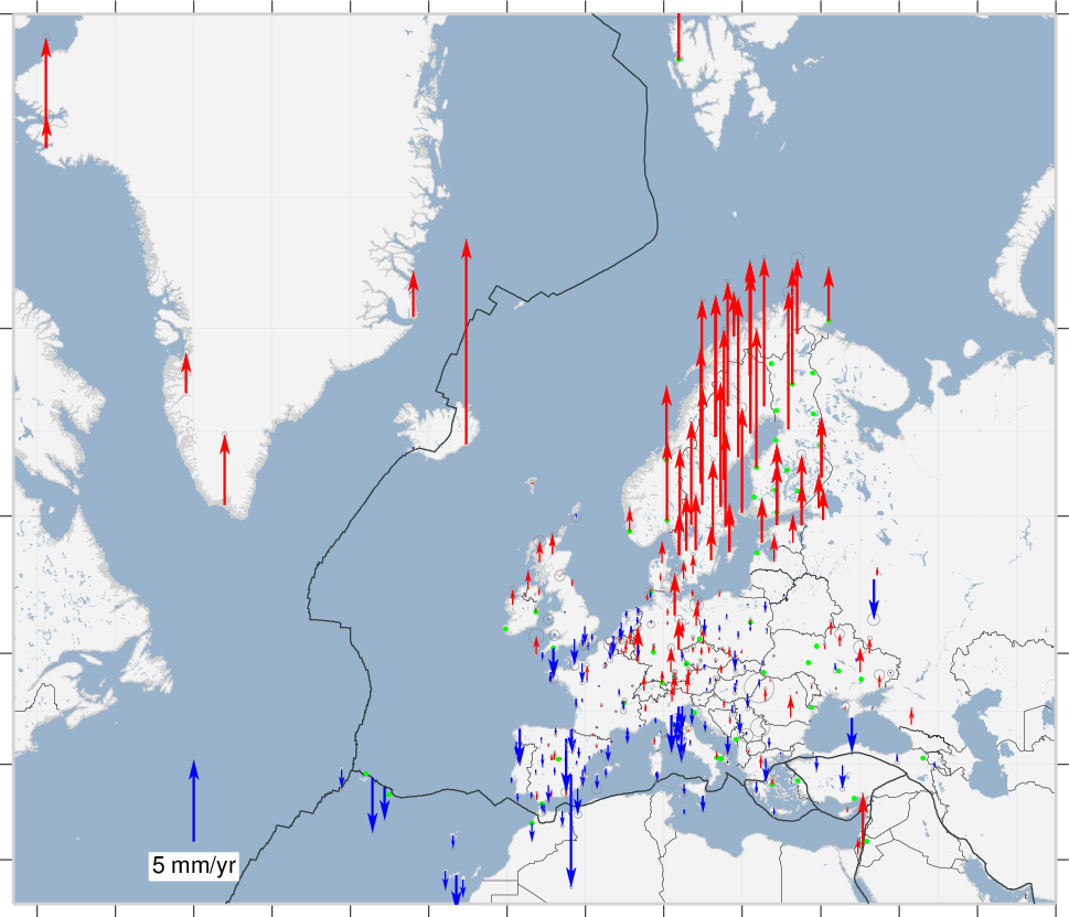
Map of EPN Station Positions & Velocities
The EPN station coordinates and velocities result from the regular time series analysis and are the most accurate and up-to-date solutions for the EPN sites. They are used for the maintenance of the regional densification of the ITRFyy between successive ITRFyy release and for the maintenance of the ETRS89:
- EPN station velocities in the latest realization (C2235) of the ITRS: IGS14
- EPN station coordinates and velocities in the ETRF2014 derived from the latest solution (C2235)
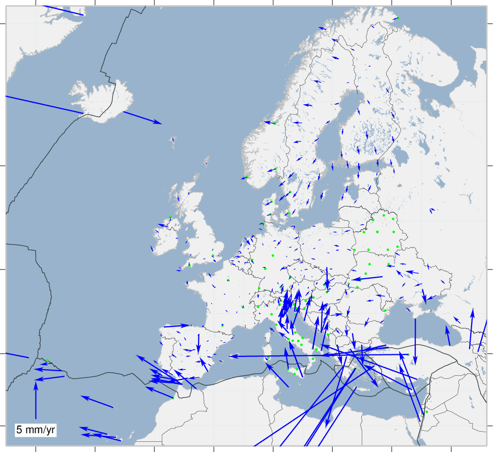
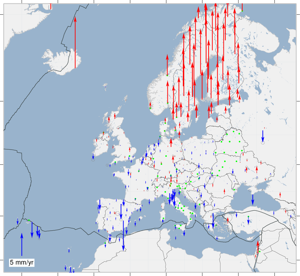
The green dots on the map indicate the youngest sites (less than 3 years of observations), which have unrealistic velocities.